Home > Image Library > US 68 / KY 80 - Eggner's Ferry Bridge >
dsc03235

[<<< Previous Image] [US 68 / KY 80 - Eggner's Ferry Bridge] [Next Image >>>]

2012:02:04 11:38:19

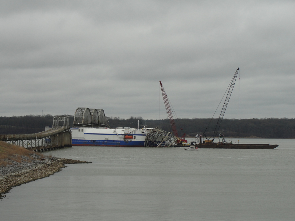
On February 4, 2012, officials allowed public access to the eastern approach to the Eggner's Ferry Bridge to view the collapsed span. The bridge carried US 68 and KY 80 over Kentucky Lake (the Tennessee River) between Marshall and Trigg counties. A mainspan of the bridge collapsed after being struck by the cargo vessel MV Delta Mariner on January 26, 2012.

Photograph by Jeffrey Carlyle. Taken 4-Feb-2012 11:38AM CST.

Related news topics: [KY 80] [Land Between the Lakes] [Marshall County] [Trigg County] [US 68]

Image Gallery: US 68 / KY 80 - Eggner's Ferry Bridge

[<<< Previous Image] [US 68 / KY 80 - Eggner's Ferry Bridge] [Next Image >>>]

Updated: 4-Feb-2012 11:38AM CST

Note: This website makes heavy use of the CSS standard. Your browser appears not to support CSS, or you may have CSS turned off for some odd reason. This page may render incorrectly since you are not using CSS. (more information on CSS)

Featured Items: [About this Site] [Hal Rogers Parkway] [Clay's Ferry Bridge] [Glen Lily Road Overpass] [Suggested Links] [Travel Information] [William H. Natcher Bridge]

Copyright © 2001-2023 by Jeffrey Carlyle. All rights reserved. This website is not associated with any government agency.