KentuckyRoads.com: The unofficial source for information about Kentucky's roads and highways.
  • Home
  • News Topics
  • Older News
  • Image Galleries
  • About This Site
  • Site Map
  • RSS
  1. Home
  2. Image Library
  3. KentuckyRoads.com - General Images
  4. ky1748obioncreekbridgeopennov2026

ky1748obioncreekbridgeopennov2026

[<<< Previous Image]
[KentuckyRoads.com - General Images]
[Next Image >>>]
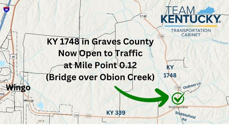
Map of KY 1748 near Wingo in Graves County, marking the reopened bridge over Obion Creek at mile point 0.12 (Kentucky Transportation Cabinet graphic)

“Map of KY 1748 just north of KY 339 in Graves County.” Graphic and caption provided by Kentucky Transportation Cabinet District 1 in a press release dated November 3, 2026. KY 1748, Graves County.

Gallery: KentuckyRoads.com - General Images
Related Topics: Graves County, KY 1748, KY 339
[<<< Previous Image]
[KentuckyRoads.com - General Images]
[Next Image >>>]
Updated: 7-Nov-2026 12:26AM CST

Featured Items

  • About this Site
  • Hal Rogers Parkway
  • Clay's Ferry Bridge
  • Glen Lily Road Overpass
  • Suggested Links
  • Travel Information
  • William H. Natcher Bridge

Copyright © 2001-2026 by Jeffrey Carlyle. All rights reserved. This website is not associated with any government agency.