Site Feature: The Roads of the Land Between the Lakes
Posted: 22-Jul-2003 4:15AM CDT
Topics: [Interstate 24] [KY 453] [KY 80] [Land Between the Lakes] [Lyon County] [Marshall County] [Site Features] [Trigg County] [US 62] [US 641] [US 68]
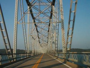
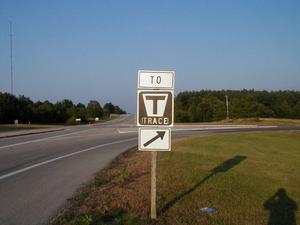
I have added a new image gallery consisting of photographs I took of the roads of the Land Between the Lakes. Subjects covered include the US 68/KY 80 bridges over the two lakes, the KY 453 bridge over the Between the Rivers Canal, and road over Kentucky Lake.
| ||||
[View all Topics]
[View all News Items] |
Comment posted by Danny Lewis on 23-Jul-2003 12:15AM CDT |
Cool! Never heard of "The Trace" before. Why was it given that name? Does it trace around the shoreline in the pennisula? |
Comment posted by Jeff Carlyle on 23-Jul-2003 12:55AM CDT |
I'm not sure what the history of the name of this particular road is; however, the word "trace" describes a course or a path. This name has been applied to several early routes through the area. For instance, other traces are the well known Natchez Trace from Nashville, TN to Natchez, MS and the Cumberland Trace, an early route through central Kentucky and northern Tennessee that connected the Wilderness Road to settlements on the Cumberland River near present day Nashville. The Trace in LBL runs north-south through roughly the center of the park. It's a narrow, winding, two-lane road which I suspect predates the creation of LBL. |
Featured Items: [About this Site] [Hal Rogers Parkway] [Clay's Ferry Bridge] [Glen Lily Road Overpass] [Suggested Links] [Travel Information] [William H. Natcher Bridge]
Copyright © 2001-2023 by Jeffrey Carlyle. All rights reserved. This website is not associated with any government agency. |